Urbanfinity is excited to release to local government the following update GIS layers:
- Accurate building vector footprints
- Building heights and building elevation heights
- Floor-space ratios for all cadastral parcels
- Secondary dwelling structures
- Pool identification
The February 2018 Geoscape data update saw 777,463 new building features added to the New South Wales database. Almost every building (greater than 9 metres squared) and address in New South Wales is now mapped.
- The state can be defined by population distribution, industrial/commercial activities and the probability of natural events such as flooding occurring
- Building attributes including building footprints in 2 and 3 dimensions, building height, building elevation, roof material, solar panels and swimming pools are now available
- Surface Cover at 30-meter resolution is now complete for all of NSW, and there has been a significant increase in Surface Cover at 2 meter resolution
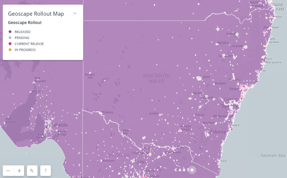
The image below shows our total coverage that is currently available, and that which is still awaiting release. As can be seen, updated data is available for the vast majority of the state. That which is not currently available is expected to be released by mid 2018.
Urbanfinity can provide detailed spatial intelligence and GIS layers including Big Data Efficiency and Aerial Compliance Tools, and additional information regarding the Geoscape data:

To find out more, or download a free sample dataset, visit our website:

For any inquiries, please contact us at service@urbanfinity.com.au