


Design & Planning Intelligence | Visual & Site Impact
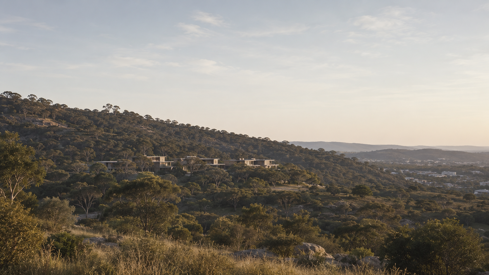
Understand how landscape and skyline visibility analysis helps assess the way a proposed building, structure or development may appear within its surrounding landscape, skyline, ridgeline, horizon or key view corridors.
The assessment can support early design review, planning documentation, visual impact work and project responses where height, massing, topography, distance or visual prominence may be relevant.
Explore the AssessmentIn Brief
Landscape and skyline visibility analysis considers how a proposed building, structure or development may appear within its surrounding landscape, urban skyline, ridgeline, horizon or view corridor. It helps project teams understand whether a proposal may appear visually prominent and how its height, massing, siting and form relate to the setting in which it may be seen.
Visibility may be influenced by topography, viewing distance, viewing angle, vegetation, surrounding development, foreground and background conditions and the degree of contrast between the proposal and its setting. The analysis may support early design review, planning documentation, responses to council concerns and broader visual assessment work where skyline, ridgeline or landscape prominence is relevant.
Landscape and skyline visibility is separate from viewshed analysis, which helps identify where a proposal may be visible from. It is also distinct from a Visual Impact Assessment, which interprets broader visual effects, sensitivity, magnitude and planning context. Requirements vary by project type, site setting, planning controls and consent authority and should be confirmed for the applicable planning pathway.
It considers how a proposal may appear within landscape, skyline, ridgeline, horizon and view-corridor conditions and the factors that influence its visual prominence.
It may support early design review, development applications, planning responses and projects where visual prominence, ridgeline position or skyline change is a concern.
The review commonly draws on surveys, architectural drawings, proposed heights and levels, site photographs, surrounding context information and relevant planning controls or council comments.
Knowledge Navigation
Use this guide to understand how landscape and skyline visibility are considered, what may make a proposal visually prominent and how project information, visual evidence and planning context shape the assessment pathway.
Foundation
Understand the visibility questions this assessment is intended to address and how it may support design review, planning documentation and project responses.
Landscape Visibility
Explore how landform, topography, vegetation, viewing distance and surrounding development influence the way a proposal is seen within a broader landscape.
Skyline Visibility
See how a proposal may appear against or alter an urban skyline, horizon line, ridgeline or broader built-form silhouette.
Planning Context
Understand why councils and project teams may consider scenic amenity, public viewpoints, view corridors, ridgelines and the relationship between built form and landscape.
Visibility Factors
Review how height, massing, siting, roof form, distance, viewing angle, material contrast, topography and vegetation may affect visual prominence.
Supporting Evidence
See how site photographs, annotated viewpoints, 3D model views, skyline reviews, line-of-sight checks and written commentary may support the assessment.
Project Information
Review the surveys, plans, elevations, sections, proposed levels, site photographs, materials and planning information commonly used in a project-specific review.
Assessment Pathway
Follow the assessment from the initial visibility question and review of project information through to viewpoint analysis, visual evidence and reporting.
System Boundaries
Understand the distinction between landscape visibility, viewshed analysis, Visual Impact Assessment, contextual analysis and other related planning systems.
Practical Guidance
Find direct answers about landscape visibility, skyline visibility, ridgelines, screening, project information and the limits of visibility assessment.
Assessment Purpose
The purpose of landscape and skyline visibility analysis is to help a project team understand how a proposed building, structure or development may present within the wider setting from which it can be seen. Rather than asking only whether the proposal is visible, the review considers the way its form relates to landscape, skyline, ridgeline, horizon and view-corridor conditions.
A proposal may be visible without necessarily appearing prominent. Equally, a relatively small part of a development may attract attention where it breaks an established ridgeline, forms a distinct silhouette against the sky or contrasts strongly with its background. The relevant question therefore depends on more than visibility alone. Height, massing, siting, topography, distance, vegetation and surrounding built form may all influence how the proposal is perceived from a particular location.
The analysis can support early design review by identifying where built form may become visually exposed or prominent before documentation is finalised. It may also support development application material, responses to council comments and the preparation of project-specific visual evidence where skyline, ridgeline, scenic-view or landscape concerns have been raised.
The scope should remain proportionate to the planning question. Some projects may require a focused review of one ridgeline or nominated public viewpoint. Others may require a broader set of views or evidence that later informs a Visual Impact Assessment. The immediate physical and planning setting may also be reviewed through Site & Contextual Analysis, but only the aspects that affect visibility and visual prominence belong within this assessment.
Visibility Question
The review considers how the proposal presents once visible, including its apparent scale, form, contrast and relationship to the surrounding landscape or skyline.
Design Review
The assessment may identify locations or design elements where height, massing, siting or silhouette create a stronger visual presence than elsewhere.
Planning Support
The review helps define whether photographs, annotated viewpoints, model views, skyline checks or written visibility commentary may be appropriate for the project.
Assessment boundary: Landscape and skyline visibility analysis describes visibility, prominence and the relationship between a proposal and its setting. It does not by itself determine the significance of a visual effect or provide the complete methodology of a formal Visual Impact Assessment.
Landscape Visibility
Landscape visibility describes the way a proposed building, structure or development is seen within a broader physical setting. The assessment is concerned not only with whether the proposal can be seen, but with how clearly it is expressed against landform, vegetation, open space, surrounding development and the visual depth of the landscape.
The same development can appear very different from separate viewing locations. From one position, it may sit below an established tree line or be read as part of an existing development pattern. From another, it may appear against open sky, above a slope or within an uninterrupted rural, coastal or bushland outlook. Viewing distance, angle and background conditions therefore influence both the visibility and apparent prominence of the proposal.
Landscape visibility may be relevant where a site occupies an elevated, exposed or visually sensitive position, or where a proposal is viewed across an open valley, water body, scenic road, public reserve or other substantial viewing distance. In urban settings, the broader landscape can also include established streetscape patterns, vegetation corridors, adjoining built form and distant topographic features.
This assessment does not replace a full landscape character study or landscape architecture review. It focuses specifically on the conditions that affect how a proposal is seen and whether its form becomes visually prominent within the available view.
Physical Setting
Slopes, valleys, escarpments, hilltops and changes in ground level can expose, conceal or visually elevate parts of a proposed development.
Landscape Structure
Existing vegetation may soften or partially screen built form, although seasonal change, vegetation condition and long-term retention should be considered where screening is relied upon.
Visual Depth
Objects and landforms at different depths affect scale, contrast and visual separation. A proposal may merge with an established background or stand out against open land or sky.
Viewing Conditions
Distance can reduce apparent detail and scale, while elevated, low-angle or direct views can increase the visibility of roof forms, upper levels and structures.
Built Context
Existing buildings, infrastructure and settlement patterns can influence whether a proposal appears as part of an established context or as a distinct new element.
Visual Relationship
Differences in height, colour, tone, material finish and form may increase visual contrast. Prominence depends on how these differences are perceived within the particular setting.
Landscape visibility is viewpoint dependent. A proposal should not be assumed to have one fixed visual presence. Its apparent scale, contrast and prominence may change substantially across public viewpoints, movement corridors and surrounding landform.
Skyline Visibility
Skyline visibility considers how a proposed development appears against the sky or contributes to the visible outline of buildings, vegetation and landform. A proposal may become particularly noticeable where it rises above surrounding development, interrupts an established ridgeline or introduces a new silhouette into an otherwise continuous horizon.
A skyline is not limited to a city-centre profile. It may be formed by suburban roofs, apartment buildings, industrial structures, tree canopies, coastal landforms or distant hills. The relevant skyline depends on the viewpoint and the visual setting. In some locations, the existing built form creates a varied and complex silhouette. In others, a simple ridgeline or open horizon may make even a relatively small change more apparent.
Skyline visibility may be influenced by the height and width of the proposal, the position of upper levels, roof forms, plant equipment, lift overruns, screening structures and other elements that extend above the main building mass. The apparent effect may also change with viewing distance, elevation and movement. A form that is concealed from a nearby street may become visible from a distant road, public reserve, waterfront or elevated residential area.
The analysis should distinguish between a development that forms part of an existing urban silhouette and one that becomes an isolated or dominant feature. Where the key question is the broader geographic area from which a proposal may be seen, a separate Viewshed Analysis may be appropriate. Skyline visibility instead focuses on how the proposal appears once it enters the view.
Built Form
An urban skyline is formed by the combined outline of buildings, infrastructure, vegetation and landform. A proposal may reinforce this pattern or introduce a visibly different height, scale or silhouette.
Landform
A ridgeline is the visible upper edge of elevated land or vegetation. Built form may become prominent where it projects above this line or competes with the natural profile.
View Composition
The horizon line is the apparent boundary between land, water, built form or vegetation and the sky. A proposal may interrupt, extend or create a new focal point along this boundary.
Architectural Form
Roof profiles, stepped upper levels, plant rooms, screens and projecting structures can shape the visible outline of a development and affect how strongly it is read against the sky.
Visual Relationship
A proposal may follow an existing pattern of height and form or create a distinct interruption. The degree of change depends on the established skyline and the position from which it is viewed.
Viewing Position
Elevated and distant viewpoints may reveal upper building elements that are not visible nearby. The proposal’s apparent height and separation from its background may therefore vary across the study area.
Skyline visibility is not determined by building height alone. The same height may appear recessive within an established urban silhouette or highly prominent where it breaks a simple ridgeline, tree canopy or open horizon.
Planning Context
Landscape and skyline visibility assessments help determine how a proposal relates to its surrounding setting. The objective is not to prevent development from being seen, but to understand whether its visibility is appropriate within the existing landscape, urban form and planning context.
Many planning authorities seek to balance new development with the qualities that make a place distinctive. Depending on the project location, this may include scenic landscapes, established skylines, ridgelines, coastal outlooks, public reserves, significant streetscapes or recognised view corridors. Understanding how a proposal appears within these settings helps inform design decisions before construction begins.
Visual prominence is only one consideration within a broader planning process. It is assessed alongside many other factors such as built form, neighbourhood character, environmental constraints, planning controls and project objectives. A proposal may be clearly visible while remaining compatible with its surroundings, whereas another may appear visually dominant despite occupying a relatively small physical footprint.
Where broader interpretation of visual effects is required, the findings may contribute to a Visual Impact Assessment. Where the primary question is identifying where a proposal may be visible across the surrounding landscape, a Viewshed Analysis may provide complementary evidence.
Landscape Character
The review considers how proposed built form relates to the established landscape rather than assessing the proposal in isolation.
Community Views
Visibility is often considered from roads, parks, lookouts, waterways and other locations where the proposal may be experienced by the public.
Design Development
Early visibility review may identify opportunities to refine building height, roof form, siting or massing before the planning process progresses.
Planning Evidence
Clear visual evidence can help explain how a proposal sits within its wider setting and support transparent planning discussions.
Important distinction: This page explains how a proposal appears within its landscape or skyline. It does not determine the overall significance of visual effects, which belongs to a broader Visual Impact Assessment.
Visibility Factors
The visibility of a proposed development is shaped by the relationship between the proposal, the viewpoint and the surrounding setting. No single factor determines whether built form will appear visually prominent. Height, massing, siting, topography, vegetation, viewing distance and background conditions usually operate together.
A tall building may appear relatively recessive where it forms part of an established urban skyline, while a smaller structure may become conspicuous where it occupies an exposed ridge or is viewed against open sky. Similarly, vegetation may provide meaningful screening from one viewpoint but have little effect from an elevated or oblique position.
The assessment therefore considers both the physical characteristics of the proposal and the conditions through which it is viewed. These factors may be reviewed during early design development, through project-specific visual evidence or as part of a broader Visual Impact Assessment.
Where the primary task is to map the wider geographic area from which a proposal may be visible, a Viewshed Analysis may be used alongside the more detailed interpretation of how the proposal appears from selected viewpoints.
Built Form
Height can affect whether a proposal rises above nearby buildings, vegetation, ridgelines or other elements that currently define the visible setting.
Built Form
The width, depth and overall volume of built form influence how much of the view it occupies and whether it is read as one large element or a series of smaller forms.
Site Relationship
The position of a proposal within the site may increase exposure, create separation from surrounding buildings or allow landform and vegetation to provide visual containment.
Site Relationship
Elevated sites, slopes and changes in ground level may expose upper building elements or increase the apparent height of a proposal from lower viewpoints.
Architectural Form
Roof profiles, stepped forms, plant rooms, lift overruns and screening structures can determine the visible silhouette and the degree of skyline interruption.
Landscape Structure
Trees and other vegetation may filter or screen views. Their effectiveness depends on density, height, season, condition, retention and the relationship between the vegetation and viewpoint.
Viewing Conditions
Greater distance generally reduces visible detail, although a proposal may remain prominent where its silhouette, scale or contrast is distinct within a broad view.
Viewing Conditions
Direct, oblique, elevated and low-level views reveal different parts of the proposal and may change its apparent height, depth and relationship to the skyline.
Visual Context
Built form may appear less distinct against a complex urban background and more conspicuous against open sky, water, undeveloped land or a simple vegetated slope.
Material Expression
The degree of contrast between proposed materials and the surrounding setting can influence how easily a structure is recognised and how strongly it attracts attention.
Material Expression
Glazing, metal finishes and light-coloured surfaces may respond differently under changing light conditions and can increase visual contrast or momentary reflectance.
Surrounding Context
Nearby buildings and infrastructure affect whether the proposal follows an established pattern or becomes a distinct new element within the view.
View Composition
A proposal located near the centre of a view, on a ridgeline or at the end of a view corridor may attract more attention than one positioned at the edge of a complex visual setting.
Movement and Duration
A view experienced from a lookout or public reserve differs from a brief moving view along a road, rail corridor, walking route or waterway.
Design Response
Stepping, setbacks, articulated façades and changes in form may reduce the appearance of continuous bulk and alter how the proposal is read from a distance.
These factors should be considered together. A proposal does not become visually prominent solely because it is tall, visible or located on sloping land. The assessment depends on how the combined design, site and viewing conditions shape its appearance within the particular landscape or skyline.
Assessment Relevance
Landscape and skyline visibility analysis may be relevant where a proposed development could become noticeable within a wider landscape, interrupt an established skyline or introduce new built form into a visually exposed setting. The need for assessment depends on the site, proposal, planning controls and the concerns raised during design or development application review.
Not every visible development requires a detailed assessment. In established urban areas, new built form may be read as part of an existing pattern of buildings and infrastructure. A more focused review may become appropriate where the proposal occupies elevated land, extends above surrounding vegetation or development, appears against open sky or is visible from recognised public viewpoints.
The assessment may be commissioned during early design development to identify potential visibility concerns before the proposal is finalised. It may also be requested by a council or planning authority where submitted material does not clearly explain the relationship between the proposal and the surrounding landscape, skyline or ridgeline.
Where visibility is likely to be widespread, a Viewshed Analysis may first help identify potential viewing areas. Where the planning question extends to the significance of visual change, viewer sensitivity or broader visual effects, a more comprehensive Visual Impact Assessment may be required.
Elevated Sites
Development on elevated or sloping land may become visible across a wider area or project above vegetation, surrounding buildings or the natural landform.
Skyline Change
A review may be useful where proposed height, roof forms or upper-level elements extend above the prevailing built form or establish a new skyline feature.
Scenic Settings
Open or visually simple landscapes may make new structures more apparent, particularly where built form contrasts with undeveloped land, water, vegetation or sky.
Public Viewpoints
Assessment may be relevant where a proposal is visible from public roads, reserves, walking routes, waterways, lookouts or other places regularly experienced by the community.
View Corridors
A proposal may require review where it enters a recognised view corridor, terminates a street view or appears within a framed outlook toward landform, water or skyline features.
Large Structures
Larger buildings, infrastructure, towers, plant equipment and other substantial structures may warrant assessment because of their scale or potential visibility from distant locations.
Planning Requests
A council may request additional visibility information where drawings or existing visual material do not adequately explain the proposal’s relationship to its broader setting.
Design Development
Early review can compare siting, height, massing or roof-form options and help identify which parts of a proposal are most exposed from relevant viewpoints.
Design Changes
Reassessment may be appropriate where revised plans alter building height, upper-level setbacks, roof forms, vegetation retention or the position of development on the site.
The appropriate scope is project specific. A focused skyline or ridgeline check may be sufficient for one proposal, while another may require multiple viewpoints, 3D visual evidence, a Viewshed Analysis or a broader Visual Impact Assessment.
Assessment Scope
A landscape and skyline visibility assessment may examine the parts of a proposal that influence how it appears within its surrounding setting. The scope is tailored to the planning question, the characteristics of the site and the type of visual evidence needed to explain the proposal clearly.
The assessment may focus on a single issue, such as whether an upper level projects above an established ridgeline, or consider several connected elements including building height, roof form, vegetation, site levels and the proposal’s relationship to surrounding development. It may also compare design options where the project team is still refining the form or position of the development.
The purpose is to identify the components that shape visibility and explain how they operate together from relevant viewpoints. The assessment should remain proportionate to the project. A small residential proposal may require a limited set of viewpoints, while a larger or more exposed development may require broader contextual review, 3D modelling or supporting Viewshed Analysis.
Where the analysis must also determine the significance of visual change, viewer sensitivity or the likely effect on landscape character, the project may require a more comprehensive Visual Impact Assessment.
Built Form
The assessment may consider the total height, width, depth and profile of the proposed building and how much of the view the envelope occupies.
Upper Form
Upper storeys, pitched roofs, parapets, plant rooms, lift overruns and screening structures may be reviewed where they contribute to the visible silhouette.
Site Position
The location of development within the site may be assessed to determine whether setbacks, lower ground or alternative positioning could reduce exposure.
Landform
Natural ground levels, excavation, fill and finished floor levels may influence the apparent height of the proposal and its relationship to ridgelines or surrounding development.
Landscape Structure
Trees and other retained vegetation may be considered where they screen, filter or frame views of the development from relevant locations.
Landscape Response
New planting, landscape buffers and screening treatments may be reviewed to understand their likely contribution over time rather than assuming immediate full screening.
Context
The proposal may be compared with nearby development to determine whether it follows, extends or departs from the prevailing pattern of height, spacing and form.
Skyline Relationship
The assessment may identify whether proposed built form rises above, overlaps with or remains below a visible ridgeline, tree canopy or horizon line.
Materials
External colours, glazing and material finishes may be considered where contrast or reflectivity could affect how clearly the proposal is perceived.
Ancillary Elements
Towers, antennas, solar equipment, plant enclosures and other ancillary structures may influence the skyline even where the main building remains comparatively recessive.
Viewpoint Review
Selected viewpoints may be assessed to explain how the proposal appears from roads, reserves, lookouts, waterways or other representative locations.
Option Testing
Different heights, roof forms, setbacks or building positions may be compared to identify how proposed changes affect visibility and skyline relationship.
The assessment scope should answer the actual planning question. It may examine only the elements needed to explain a particular skyline or landscape relationship rather than expanding into a complete evaluation of visual impact.
Assessment Evidence
Landscape and skyline visibility should be explained through evidence that accurately represents the proposal, the surrounding setting and the relevant viewing conditions. The form of evidence depends on the project scale, site complexity and the planning question being addressed.
The assessment may draw on architectural drawings, survey information, site photography, topographic data and three-dimensional modelling. These sources help establish the proposed building envelope, existing landform, vegetation, surrounding development and the relationship between the proposal and selected viewpoints.
Evidence should be proportionate and transparent. A straightforward skyline relationship may be explained through elevations and verified site photographs, while a more complex or distant visibility question may require a geolocated 3D model, photomontages or terrain-based analysis. The objective is not to produce the most elaborate visual material possible, but to provide enough reliable information to understand the proposal within its setting.
Where the geographic extent of potential visibility remains uncertain, a Viewshed Analysis may help identify areas for further investigation. Where visual simulations are used to support conclusions about broader visual effects, they may form part of a more comprehensive Visual Impact Assessment.
Project Documentation
Site plans, floor plans, elevations, sections and roof plans help establish the proposed height, form, setbacks and relationship to site boundaries and levels.
Site Geometry
Boundary, contour, spot-level and feature survey data may be used to position the proposal accurately within the existing topography and surrounding context.
Existing Conditions
Photographs record the visible character of the site, skyline, vegetation, landform and surrounding built form from relevant public or representative locations.
Spatial Context
Aerial imagery, cadastral mapping and geographic information may help identify surrounding development patterns, roads, reserves, waterways and potential viewpoints.
Terrain Evidence
Digital terrain, contour and elevation data may be used to understand ridgelines, slopes, depressions and the relative elevation of the site and surrounding viewing locations.
Digital Representation
A 3D model can represent the proposed building, landform and surrounding context to test how the development appears from selected positions and elevations.
Viewpoint Evidence
Recorded viewpoint coordinates, camera height, direction and lens information improve transparency where photographs or visual simulations are used as assessment evidence.
Visual Comparison
Visualisations may combine the proposed model with site photography to show the anticipated building outline, scale and skyline relationship from a defined viewpoint.
Planning Framework
Relevant planning provisions may identify scenic areas, view corridors, height controls, landscape character objectives or expectations for development on visually sensitive land.
Landscape Context
Arborist information and landscape plans may help distinguish retained vegetation from proposed planting and assess the likely timing and reliability of screening.
Design Review
Alternative models or drawings may be compared to explain how changes in height, siting, setbacks or roof form affect the visible outcome.
Supporting Records
The assessment should record the evidence relied upon, relevant limitations and any assumptions about vegetation, future development, viewing access or design information.
Visual evidence should clarify rather than dramatise. Its purpose is to provide a credible representation of the proposal’s scale, position and relationship to the landscape or skyline, with methods and assumptions that can be understood by the project team and planning authority.
Project Information
The quality of a landscape and skyline visibility assessment depends on the accuracy of the project information available. Architectural drawings, survey data, site levels, contextual information and clearly defined planning questions help establish the proposal’s position, form and relationship to the surrounding setting.
The information required will vary according to the stage and complexity of the project. Early design advice may proceed using concept drawings and preliminary massing, while formal planning evidence will generally require coordinated architectural documentation and reliable survey information. Where visibility from distant or elevated locations is being assessed, accurate geolocation and level data become particularly important.
The project team should also identify the specific issue that needs to be explained. This may relate to an exposed upper level, a proposed ridgeline crossing, visibility from a public reserve or the relationship between the proposal and an established skyline. A clear question helps determine which viewpoints, drawings and modelling methods are proportionate.
Not every project will require every item listed below. Certified Energy can review the available documentation and identify whether additional survey, photography, modelling or a complementary Viewshed Analysis may be needed before the assessment scope is confirmed.
Core Documentation
Current site plans, floor plans, elevations, sections and roof plans establish the proposed building footprint, envelope, height and upper-level form.
Site Accuracy
A survey may provide boundaries, contours, spot levels, existing structures, significant vegetation and other site features needed to position the proposal accurately.
Vertical Relationship
Natural ground levels, finished floor levels, roof levels and the height of rooftop elements help establish the proposal’s relationship to landform, ridgelines and surrounding development.
Existing Context
Recent photographs help document current landform, vegetation, built form, skyline conditions and views toward the site from accessible locations.
Digital Inputs
A coordinated digital model may improve efficiency and accuracy when testing viewpoints, comparing design options or preparing visual representations of the proposal.
Landscape Information
Information about retained trees, vegetation removal, proposed planting and expected mature heights helps distinguish existing screening from future landscape measures.
Material Information
Schedules or concept selections for façades, roofs, glazing and metalwork may be relevant where contrast, tonal response or reflectivity could influence visibility.
Planning Context
Planning provisions, council correspondence and requests for further information help clarify whether the assessment must address a skyline, ridgeline, scenic setting or nominated viewpoint.
Assessment Direction
A clear description of the concern helps focus the assessment on the relevant building elements, locations and landscape or skyline relationships.
Viewing Locations
Any viewpoints nominated by council, the project team or existing planning documentation should be identified so their relevance and accessibility can be reviewed.
Project Stage
Knowing whether the proposal is conceptual, coordinated or already submitted helps determine the appropriate level of precision and whether alternative options remain available.
Related Studies
Previous visual studies, contextual analysis, planning reports or site investigations may provide useful evidence and prevent unnecessary duplication of work.
Incomplete information does not always prevent an early review. Concept-stage analysis may help identify likely concerns and documentation gaps, but formal planning conclusions should be based on coordinated design information and reliable site data.
Assessment Process
Every project presents different landscape conditions, planning objectives and visibility questions. The assessment process is therefore adapted to the proposal rather than following a rigid checklist. The overall objective is to explain how the development sits within its wider landscape and skyline using evidence that is proportionate to the project.
The process generally begins by understanding the proposal, reviewing available documentation and identifying the planning issue that requires investigation. From there, the surrounding landscape, landform, skyline and representative viewpoints can be examined before appropriate visual evidence is prepared and the findings documented.
Some projects require only a focused review of a single ridgeline or public viewpoint. Others may involve multiple viewpoints, digital terrain modelling, three-dimensional visualisation or supporting Viewshed Analysis. The scope should always reflect the planning question rather than applying unnecessary complexity.
Step 1
Architectural drawings, survey information, site levels and project objectives are reviewed to understand the proposed development and its physical relationship to the site.
Step 2
The assessment identifies exactly what needs to be explained, such as skyline interruption, ridgeline visibility, public viewpoints or broader landscape prominence.
Step 3
Landform, vegetation, surrounding development, skyline conditions and landscape character are reviewed to establish the existing visual setting.
Step 4
Relevant public or representative viewing locations are identified to demonstrate how the proposal is experienced within the wider landscape.
Step 5
The proposal is assessed in relation to topography, skyline, vegetation, viewing distance, surrounding buildings and the overall landscape composition.
Step 6
Where appropriate, photographs, verified viewpoints, photomontages, 3D models or terrain-based analysis are prepared to communicate the findings clearly.
Step 7
The report explains how the proposal appears within the surrounding landscape or skyline, describes the evidence used and records any assumptions or limitations.
Step 8
The completed assessment provides transparent visual evidence that can support design refinement, planning review and informed decision making throughout the project.
Every assessment is proportionate to the project. A single dwelling on an established suburban street may require only limited analysis, while larger developments or projects in visually sensitive landscapes may involve more detailed modelling, additional viewpoints or complementary technical studies.
Related Assessments
Landscape and skyline visibility is one part of a broader visual and site impact framework. It focuses on how a proposal appears within the surrounding landscape, ridgeline, horizon or skyline. Other assessments answer different questions and may be used separately or together depending on the project.
The distinction between these studies is important because visibility does not automatically establish visual impact. A proposal may be visible across a broad area but remain visually recessive within an established urban setting. Conversely, a proposal visible from only a limited number of locations may still become prominent where it interrupts a sensitive ridgeline or occupies a recognised view corridor.
Selecting the correct assessment pathway helps avoid unnecessary duplication and ensures that the evidence directly responds to the planning question. Certified Energy can review the project context and determine whether landscape and skyline visibility should stand alone or be supported by related visual, contextual or solar access studies.
Geographic Visibility
A Viewshed Analysis identifies the geographic areas from which a proposed development may potentially be visible using terrain, elevation and spatial modelling.
Question answered: Where can the proposal be seen?
Visual Effects
A Visual Impact Assessment considers the nature and significance of visual change, including viewer sensitivity, landscape character and the likely visual effects of the proposal.
Question answered: What are the visual implications?
Site Relationship
Site contextual analysis reviews the relationship between a proposal and its surrounding built form, land use, streetscape, topography and broader development pattern.
Question answered: How does the proposal relate to its site context?
Overshadowing Evidence
Shadow Diagrams show where shadows cast by proposed and existing built form fall at nominated times and dates. They assess solar obstruction rather than landscape prominence.
Question answered: Where does the shadow fall?
Design Performance
Solar Access and Overshadowing Analysis examines whether a design provides appropriate sunlight to dwellings, private open space and neighbouring properties.
Question answered: Is solar access appropriately maintained?
Point-Based Solar Access
Sun Eye Diagrams show the sky and solar access available from a specific point such as a window, balcony, courtyard or neighbouring property.
Question answered: How much sky and sun can this point receive?
The studies are connected, but they are not interchangeable. Landscape and skyline visibility explains how a proposal appears within its wider setting. It should only expand into viewshed mapping, visual impact evaluation, contextual analysis or solar access assessment where those separate questions are genuinely part of the project brief.
Frequently Asked Questions
A Landscape & Skyline Visibility Assessment examines how a proposed building, structure or development appears within its surrounding landscape, ridgeline, horizon or skyline.
It may consider visual prominence, building form, height, landform, vegetation, surrounding development and the proposal’s relationship to representative public or semi-public viewpoints.
The assessment may be relevant where a proposal is located on elevated, sloping or visually exposed land, near a recognised ridgeline, scenic area, horizon line or important view corridor.
It may also be requested where a planning authority requires further evidence about building prominence, upper-level visibility, roof form, infrastructure or the way a development sits within its wider landscape setting.
No. A Viewshed Analysis identifies the geographic areas from which a proposal may potentially be visible.
Landscape and skyline visibility assessment considers how the proposal appears from relevant locations, including its scale, prominence and relationship to landform, vegetation, surrounding buildings and the skyline.
No. A Visual Impact Assessment generally considers the nature and significance of visual change, including landscape character, viewer sensitivity and broader visual effects.
Landscape and skyline visibility is more focused. It explains how the proposal appears within its setting but does not automatically provide a complete evaluation of visual impact significance.
No. A proposal may be visible without becoming visually dominant or inconsistent with its surroundings.
Viewing distance, topography, vegetation, surrounding development, colour, reflectivity and the amount of the building visible can all influence how prominent the proposal appears. Visibility alone does not determine the planning outcome.
Viewpoints are generally selected to represent locations from which the proposal may reasonably be experienced and where its landscape or skyline relationship can be understood.
Selection may consider public roads, reserves, walking routes, scenic locations, planning controls, council requests, viewing distance, elevation and whether the proposal is likely to interrupt a ridgeline, horizon or established skyline.
Not automatically. The assessment often focuses on public or representative viewpoints and the wider landscape or skyline relationship.
Whether a private viewpoint is relevant depends on the applicable planning framework, the project brief and the issue raised by the planning authority. Specific private view impacts may require a separate planning assessment.
Existing vegetation may reduce visibility, but its reliability should be considered carefully.
Species, density, seasonal change, health, ownership, likely retention and future growth can all affect the screening outcome. Vegetation should not be treated as permanent screening where its retention or long-term effectiveness is uncertain.
Proposed landscaping may soften lower building elements, improve the foreground setting or reduce visual contrast from some viewpoints.
It may not resolve a building form that projects above a ridgeline or interrupts a horizon. In those circumstances, height, siting, upper-level setbacks, roof form and massing may have greater influence than planting alone.
No. Some landscape and skyline relationships can be explained through architectural elevations, sections, site photographs and contextual analysis.
Photomontages or three-dimensional visualisations may be appropriate where the proposal’s scale, position or relationship to a ridgeline or skyline cannot be communicated clearly through drawings alone.
Yes. Early assessment can help identify potentially exposed building elements, sensitive ridgeline relationships and locations from which the proposal may appear prominent.
This may support changes to building height, siting, roof form, upper-level massing, materials or landscape strategy while design options remain available.
Useful starting information commonly includes architectural plans, elevations, sections, a feature and level survey, existing and proposed site levels and recent site photography.
Landscape plans, material schedules, digital models, planning controls, council correspondence and any nominated viewpoints may also be required depending on the project and agreed scope.
No. The assessment provides technical evidence about how the proposal appears within its landscape or skyline context.
The consent authority considers that evidence alongside the applicable planning controls, the broader development application, submissions and other relevant planning matters. The assessment cannot guarantee approval or a particular planning outcome.
Project Specific Requirements
The relevant viewpoints, assessment extent, visual evidence and reporting requirements depend on the development type, site context, planning instrument and consent authority. These answers provide general planning guidance and should not be treated as legal advice, approval advice or a substitute for confirming the controls applying to the specific project.
Related Knowledge
Landscape and skyline visibility may draw on mapped visibility data, contextual site information and visual evidence from representative viewpoints. Each related assessment retains a distinct role within the wider Design & Planning Intelligence system.
Geographic Visibility
Explore how terrain and elevation data can identify the surrounding locations from which a proposed building, structure or landscape feature may potentially be visible.
Explore Viewshed Analysis →
Visual Effects Assessment
Understand how the visual implications of a proposed development may be considered in relation to landscape character, viewer sensitivity and the nature of visual change.
Explore Visual Impact Assessment →
Built and Landscape Context
Explore how a proposal relates to surrounding built form, land use, streetscape, topography, vegetation and the wider development pattern of its site.
Explore Site Contextual Analysis →
Verified Visual Representation
Understand how proposed building form may be represented from defined viewpoints using site photography, camera information and coordinated three-dimensional modelling.
Explore Photomontage & Visualisation →
Solar Access and Built Form
Explore how proposed building height, orientation and massing may affect direct sunlight access to dwellings, open space and neighbouring properties.
Explore Solar Access & Overshadowing →
Visual Shadow Documentation
Learn how shadow diagrams document the location and extent of shadows cast by existing and proposed built form at nominated dates and times.
Explore Shadow Diagrams →
Design & Planning Gateway
Explore planning, site intelligence and building performance assessment pathways according to the project context, design question and evidence required.
Explore the Design & Planning Intelligence gateway →
Landscape & Skyline Visibility Project Review
Send the available architectural drawings, survey information, site photography and any council comments or requests for further information relating to visual prominence, ridgelines, horizon lines, view corridors or skyline appearance.
Certified Energy can review the proposed development, surrounding landscape context, documentation status and planning question to help identify the appropriate assessment pathway, likely project inputs and whether supporting Viewshed Analysis, verified visualisations or a broader Visual Impact Assessment may also be relevant.
Assessment scope, representative viewpoints, supporting visual evidence and reporting requirements depend on the development type, site context, applicable planning controls and information requested by the relevant consent authority.
Last reviewed: July 2026. This page is maintained by Certified Energy as part of its Design & Planning Intelligence Hub.
