


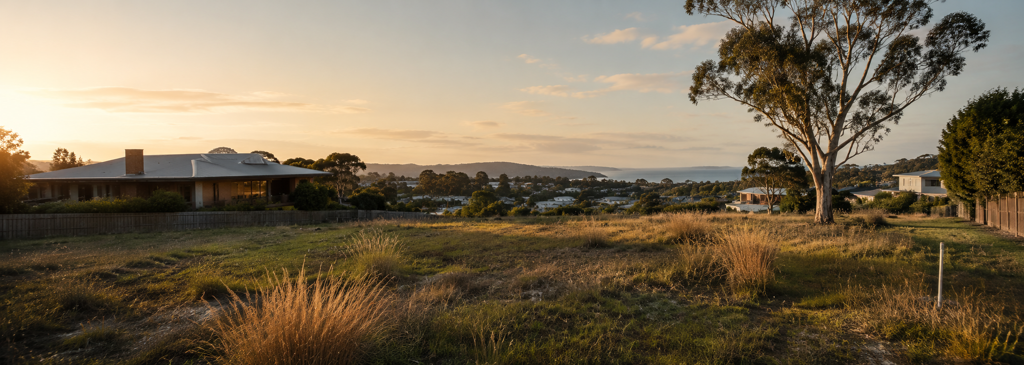
Design & Planning Intelligence | Visual & Site Impact
Understand how site and contextual analysis helps project teams examine the physical, surrounding and planning context that may shape a proposed development.
The review can support early project assessment, planning documentation, design coordination and the identification of more specific assessment pathways where required by the site, project or relevant planning controls.
Explore the Site ContextIn Brief
Site and contextual analysis is the structured review of a development site and the immediate physical, built and planning conditions that surround it. Site analysis focuses on the subject land itself, including boundaries, orientation, levels, slope, access, frontage, vegetation, existing structures and available project information. Contextual analysis considers how that site relates to adjoining properties, surrounding land uses, streetscape character, built-form scale, setbacks, height patterns, public spaces and relevant planning controls.
Understanding these conditions can help project teams identify constraints, opportunities, documentation gaps and relationships that may influence design coordination, planning responses or the scope of further assessment. It can also support early review of difficult, sloping or constrained sites and projects where neighbouring development or council comments raise questions about the surrounding context.
Site and contextual analysis is not the same as a Visual Impact Assessment, which interprets visual effects, receptors, sensitivity and magnitude. It is also distinct from Viewshed Analysis, which maps where a proposal may be visible from, and from Landscape & Skyline Visibility, which focuses on broader landscape, ridgeline, skyline and view-corridor relationships. The scope of a context review depends on the project, site setting, applicable planning controls and assessment pathway.
It reviews the subject site, adjoining properties, surrounding built form, land use, topography, access, vegetation, streetscape and relevant planning context.
It may support early feasibility, design coordination, development application preparation, responses to council comments and the selection of specialist assessment pathways.
The review may draw on surveys, architectural drawings, levels, site and context photographs, planning controls, council comments and information about neighbouring development.
Knowledge Navigation
Use this guide to understand how a development site and its surrounding context may be reviewed, which physical and planning conditions are commonly considered and how the findings can support project coordination and more specific assessment pathways.
Foundation
Understand why project teams review the site and its surroundings before preparing planning responses, coordinating design work or selecting specialist studies.
Site Analysis
Review boundaries, orientation, levels, slope, access, frontage, vegetation, existing structures and other project-relevant site conditions.
Contextual Analysis
Explore how neighbouring buildings, land uses, streetscape, setbacks, height patterns, local character and the public domain shape the site setting.
Planning Context
Understand how zoning, local controls, stated objectives, council comments and the applicable planning pathway may inform a contextual review.
Site Factors
Review the physical, built, environmental and planning factors that may influence how a site is understood and how further assessment is scoped.
Project Relevance
See how contextual review may assist new development, alterations, constrained sites, early feasibility, development applications and responses to council questions.
Project Information
Review the surveys, architectural drawings, levels, photographs, planning information, council comments and neighbouring context commonly used in a project-specific review.
Assessment Pathway
Follow the review from the initial project question and available information through to site findings, contextual observations and identification of further assessment needs.
System Boundaries
Understand the distinction between site context, Visual Impact Assessment, Viewshed Analysis, landscape visibility and design performance advice.
Practical Guidance
Find direct answers about site analysis, contextual analysis, planning context, project information and the limits of a site context review.
Purpose
Every development proposal begins within an existing physical and planning environment. Before questions about visual impact, environmental performance or specialist technical assessments can be answered, it is important to understand the site itself and how it relates to its immediate surroundings. Site and contextual analysis provides that foundation by bringing together information about the land, neighbouring development, surrounding character and the planning framework that may influence a project.
Rather than evaluating whether a proposal is acceptable or predicting assessment outcomes, the purpose of a site context review is to build a clear understanding of the conditions that already exist. This helps project teams identify opportunities, recognise potential constraints, coordinate documentation and determine whether additional specialist investigations may be appropriate as the project progresses.
The scope of a review varies between projects. A straightforward residential development may only require a concise understanding of the site and surrounding built form, while larger or more complex developments may involve a broader review of planning context, neighbouring relationships and project-specific considerations. The appropriate scope should always be considered in relation to the site, the proposed development and the applicable planning pathway.
Physical Setting
Review the land itself, including orientation, topography, access, vegetation, existing structures and other characteristics that define the physical setting of the project.
Surrounding Context
Consider neighbouring buildings, surrounding land uses, streetscape character, built-form relationships and the broader context in which the proposal will sit.
Project Direction
A clear understanding of site context can help identify information gaps, coordinate project documentation and determine whether more specialised assessment pathways may be relevant.
Site Analysis
Site analysis focuses on the physical and project-relevant conditions of the subject land. It brings together information about the site’s form, orientation, levels, access, existing development and visible constraints so that the project team can understand the setting in which the proposal is being prepared.
The review is not intended to replace a survey, engineering assessment, ecological report, heritage study or other specialist investigation. Instead, it provides a structured overview of the conditions that may influence project documentation, contextual relationships and the need for further assessment.
Site Definition
Site boundaries, lot configuration, frontage and the relationship between the proposed work and the legal extent of the land may be reviewed using available survey and project information.
Site Position
Orientation can help explain the site’s relationship to the street, adjoining properties, prevailing environmental conditions and surrounding built form without becoming a detailed solar or climate-responsive design assessment.
Landform
Existing levels, changes in ground height, slope direction and local topography may influence how the proposal relates to neighbouring land, access points and the surrounding streetscape.
Movement
Existing and proposed access, driveway position, street frontage and the relationship between the site and public domain may be relevant to understanding the immediate project context.
Existing Development
Existing buildings, retaining walls, fences, outbuildings and other visible site features may affect how the proposal is understood and how new work connects with existing conditions.
Landscape Conditions
Existing trees, planted areas and screening vegetation may form part of the site setting. Where specialist arboricultural, ecological or landscape advice is required, those matters should be reviewed separately.
Site Relationships
The location, levels, setbacks and built form of adjoining properties may help explain the site’s immediate relationships and identify questions that require closer contextual or specialist review.
Available Evidence
Survey information, plans, photographs and visible easements or constraints may be considered where relevant. Their accuracy and significance should be confirmed through the appropriate project documentation and specialist advice.
Contextual Analysis
Contextual analysis looks beyond the subject site to understand how it relates to the surrounding built environment, adjoining properties, streetscape, land uses and planning setting. It considers the patterns and relationships that already define the area so that a proposed development can be reviewed within its actual setting rather than as an isolated object.
The purpose is not to make a final planning determination or complete a formal visual impact assessment. Instead, the analysis provides a structured understanding of the surrounding conditions that may influence project coordination, planning documentation and the need for more specific specialist studies.
Adjoining Context
The position, scale, setbacks, height and form of neighbouring buildings may help explain the immediate relationships that influence how a proposal is understood.
Land Use Pattern
Residential, commercial, mixed-use, industrial, open-space or community uses may shape the character of the area and the questions relevant to the proposed development.
Street Relationship
Building alignment, setbacks, entries, fencing, landscaping and the public-facing edge of nearby sites can help describe how development addresses the street.
Built Form
Patterns of height, bulk, spacing and setbacks may be reviewed to understand the existing built-form context without making a final judgement about planning acceptability.
Area Character
Recurring building types, materials, landscape patterns, street rhythm and development scale may contribute to the character of the immediate area where relevant to the project question.
Public Realm
Footpaths, roads, public open space, street trees and other shared spaces may form part of the surrounding context where they influence the site’s relationship to the public domain.
Landscape Setting
Trees, landscape buffers, planted setbacks and vegetation on neighbouring or public land may contribute to the immediate context and existing degree of enclosure or screening.
Contextual Relationships
Relevant relationships between buildings, streets, open areas and nearby viewpoints may be noted at a contextual level. Detailed visibility mapping or visual impact interpretation should be addressed through the appropriate specialist assessment.
A contextual review identifies relationships rather than determining outcomes. Whether a proposal is acceptable under the applicable planning framework remains subject to the relevant controls, supporting evidence and consent authority assessment.
Planning Context
The physical characteristics of a site are only one part of the broader project picture. A contextual review may also consider the planning framework that applies to the land, helping project teams understand the questions that planning authorities, consultants and other stakeholders may ask during project development. The objective is to understand the planning setting rather than provide statutory planning advice.
Planning requirements differ between Australian states, territories and local councils. The relevance of individual planning controls depends on the site, proposed development and assessment pathway, and should always be confirmed against the applicable planning instruments and consent authority requirements.
Land Use Planning
The applicable zoning and intended land use may help establish the broader planning context for the proposal and the type of development being considered.
Planning Controls
Depending on the project, local environmental plans, development control plans, overlays or other planning instruments may provide context for understanding the site.
Assessment Pathway
Different development pathways may require different supporting information. A contextual review can help identify questions that may influence project documentation.
Project Coordination
Where available, council comments, requests for information or project-specific questions may help focus the contextual review and identify areas requiring additional investigation.
• Applicable zoning
• Local planning controls
• Development objectives
• Neighbourhood character provisions
• Site-specific planning considerations
• Relevant council feedback
• Applicable assessment pathway
• Project documentation available for review
Important: Site & Contextual Analysis is not a substitute for statutory town planning advice. It provides project-specific context that may support design coordination and assessment preparation, while planning conclusions remain subject to the applicable planning framework and consent authority.
Site Factors
Every site presents a different combination of physical, environmental and contextual conditions. The matters considered during a review depend on the project, the available information and the questions being investigated. Rather than following a fixed checklist, the assessment is typically tailored to the characteristics of the site and its surrounding environment.
The following examples represent common considerations that may contribute to a broader understanding of the site before more specialised technical or statutory assessments are undertaken.
Topography
Existing ground levels, slopes, ridges, depressions and overall landform may influence the opportunities and constraints associated with the site.
Orientation
The relationship between the site, adjoining streets and surrounding properties may help explain the overall project setting.
Existing Development
Existing buildings, retaining walls, services and site infrastructure may contribute to the understanding of current site conditions.
Access
Existing access arrangements, street connections and movement patterns may form part of the broader site review.
Vegetation
Trees, planting, natural features and existing vegetation may contribute to the character and physical setting of the site.
Neighbourhood
Neighbouring buildings, land uses and streetscape relationships help establish the context surrounding the subject site.
Public Domain
Roads, footpaths, public open space and adjoining public areas often form part of the broader contextual review.
Planning Framework
Relevant planning controls may provide important context for understanding the site and identifying project-specific considerations.
Infrastructure
Visible infrastructure, easements and servicing arrangements may contribute to the overall understanding of site conditions.
Documentation
Site surveys, plans, aerial imagery, photographs and project documentation help establish the evidence base for the review.
Constraints
Physical, contextual or documented constraints may help determine whether further specialist investigations are appropriate.
Project Scope
Every review is guided by the questions being investigated, the stage of the project and the information available at that point in the design process.
Project Relevance
Site and contextual analysis may be useful whenever a project team needs a clearer understanding of the land, its immediate surroundings and the planning setting before progressing design work or preparing supporting documentation. It is particularly valuable where the site presents unusual conditions, the surrounding context is sensitive or the appropriate specialist assessment pathway is not yet clear.
The review can be undertaken at different stages of a project. Early analysis may help identify constraints and information gaps, while a later review may respond to design changes, council comments or specific contextual questions raised during the assessment process.
Early Project Stage
An early review can help the project team understand the site setting, identify known constraints and determine which contextual questions should be addressed before the design develops further.
Design Development
Site and contextual findings can support coordination between architectural, planning and specialist project information by making the relevant existing conditions easier to understand.
Planning Preparation
A structured review may help establish the site and surrounding context used in planning documentation, while statutory planning conclusions remain the responsibility of the relevant planning professionals and authority.
Complex Conditions
Sites with steep levels, limited access, irregular boundaries, close neighbouring development or other physical constraints may benefit from a clearer contextual overview before specialist studies are commissioned.
Urban Context
Infill development may require close consideration of neighbouring buildings, street alignment, established scale, land-use patterns and the relationship between new work and the surrounding area.
Larger Projects
Projects involving greater height, scale, multiple buildings or mixed land uses may require a broader understanding of adjoining development, public-domain relationships and the wider planning setting.
Project Response
Where a consent authority requests clarification about the site, neighbouring context or project relationships, a focused review may help organise the relevant information and identify further evidence requirements.
Scope Definition
The review may help determine whether the project requires more specific work such as a Visual Impact Assessment, Viewshed Analysis, landscape visibility review, solar access analysis or another specialist study.
A site context review is most useful when its findings can still inform project decisions. For many developments, this means undertaking the review before the design and supporting documentation are finalised. Where a specific issue emerges later, the scope can instead be focused on the site or contextual question requiring clarification.
Project Information
A site and contextual review relies on information that explains both the subject land and the development being considered. The required material depends on the project stage, the complexity of the site and the questions the review is intended to address. Early-stage work may proceed from limited information, while a more detailed project-specific review generally requires coordinated drawings, reliable levels and clear evidence of the surrounding context.
Not every item below will be required for every project. The purpose of the initial information review is to establish what is already known, identify significant gaps and determine whether the available material is suitable for the intended assessment.
Site Definition
A current survey may establish site boundaries, existing levels, structures, significant features and the position of adjoining development where these matters have been recorded.
Proposed Development
Plans can show the proposed footprint, setbacks, access, internal organisation and relationship between new development, existing site features and adjoining properties.
Built Form
Elevations and sections help explain height, form, ground relationships, floor levels and the way the proposal responds to changes across the site.
Vertical Relationships
Reliable ground, floor, roof and boundary levels are particularly important where topography, retaining, adjoining development or changes in height influence the project context.
Site Evidence
Clear photographs can document existing conditions, neighbouring buildings, street character, vegetation, access points and other relationships that may not be fully represented in drawings.
Wider Setting
Aerial imagery and mapping may help establish the wider street network, subdivision pattern, surrounding land uses, open space and broader relationship between the site and its locality.
Planning Framework
Applicable zoning, development controls, overlays, objectives and project-specific requirements may be reviewed to understand which contextual matters are relevant to the assessment.
Authority Feedback
Pre-application advice, assessment comments and requests for additional information can help define the specific site or contextual questions that require clarification.
Design Intent
A concise description of the proposed development, current project stage and intended outcome helps ensure that the review remains focused on the relevant project questions.
Surrounding Development
Available information about adjoining buildings, levels, setbacks, uses and approved development may assist where neighbouring relationships are relevant to the review.
Material Development
Preliminary material, colour and landscape information may provide useful context where the external character and relationship to surrounding development form part of the project question.
Previous Work
Relevant planning, heritage, arboricultural, ecological, traffic or technical reports may help clarify existing constraints, although their specialist conclusions should not be independently reinterpreted outside the appropriate scope.
The reliability of the findings depends on the accuracy, currency and coordination of the information supplied. Where drawings conflict, levels are incomplete or surrounding conditions are not clearly documented, the review may identify assumptions, limitations or additional information that should be resolved before a more detailed assessment proceeds.
Assessment Pathway
The review process begins by identifying the project question and determining which aspects of the site and surrounding context are relevant. Available drawings, surveys, photographs and planning information are then examined together so that physical conditions, contextual relationships and information gaps can be understood as part of one coordinated review.
The scope is adjusted to the project rather than applied as a standardised technical assessment. Some reviews may provide an early contextual overview, while others may focus on a specific issue raised by the design team, planning consultant or consent authority.
Define the Review
The process starts by establishing why the review is required, which project stage it will support and whether the focus is broad site understanding, design coordination, planning preparation or a specific contextual issue.
Information Review
Survey information, architectural drawings, proposed levels, site photographs, aerial imagery, planning controls and relevant authority comments are reviewed to establish the evidence available for the analysis.
Site Conditions
The subject land is considered in terms of boundaries, orientation, topography, access, existing structures, vegetation and other physical conditions relevant to the project question.
Contextual Conditions
Adjoining buildings, surrounding land uses, streetscape patterns, public-domain relationships and broader built-form conditions are reviewed where they help explain the site context.
Context Interpretation
The site and surrounding information are considered together to identify physical relationships, known opportunities, potential constraints and contextual matters that may require clearer documentation or further investigation.
Scope Review
Where the review identifies a more specific visibility, landscape, solar, environmental or planning question, the project team can consider whether a dedicated specialist assessment is appropriate.
Review Outcome
The outcome may include written observations, annotated material, an information-gap review, contextual findings or recommendations about the next assessment step, depending on the agreed scope.
Project-Specific Scope
Site and contextual analysis reflects the information available at the time of review. Where the design, proposed levels, surrounding development or planning requirements change, earlier findings may need to be reconsidered so that the analysis remains aligned with the current project.
System Boundaries
Site and contextual analysis provides a broad foundation for understanding the subject land, its immediate surroundings and the project questions that may require further investigation. It does not replace a specialist assessment where a proposal needs detailed modelling, verified viewpoints, formal impact interpretation or technical planning evidence.
The most appropriate pathway depends on the issue being examined. A contextual review may help define that issue and identify the information required, while the related assessments below address narrower and more technically specific questions.
Current Assessment
Examines the physical site, adjoining properties, surrounding built form, land uses, streetscape and relevant planning context.
Primary question: What conditions define this site and its surrounding context?
Visual Effect
Evaluates how a proposed development may affect visual character, identified viewpoints, visual receptors and the surrounding visual environment.
Primary question: What visual effect may the proposal have?
Geographic Visibility
Uses terrain, elevation and project geometry to investigate the geographic areas from which a proposed development may potentially be visible.
Primary question: From where may the proposal be visible?
Landscape Relationship
Considers how a proposal may appear within a landscape, against a ridgeline, across a horizon or as part of an existing urban skyline.
Primary question: How does the proposal relate to the landscape or skyline?
Solar Relationship
Examines how development form and siting may affect solar access to the subject development, neighbouring properties and relevant outdoor or internal spaces.
Primary question: How does the proposal affect access to sunlight?
Statutory Interpretation
Interprets the statutory planning framework, assesses compliance with applicable controls and advises on development approval strategy and planning outcomes.
Primary question: How should the proposal respond to the planning framework?
Selecting the Right Pathway
These assessments are related but not interchangeable. A project may begin with site and contextual analysis and later require a dedicated visibility, solar or planning study where the relevant issue needs more detailed evidence. Separating the assessments allows each report to answer a clear question using an appropriate method and evidence base.
Frequently Asked Questions
Site and contextual analysis is a structured review of the subject site, adjoining properties, surrounding development, streetscape, land uses and relevant planning setting.
Its purpose is to establish the conditions and relationships that may influence a project before more detailed design, planning or specialist assessment work is undertaken.
Site analysis focuses on the physical characteristics of the subject land, including boundaries, orientation, topography, access, existing structures and vegetation.
Context analysis considers the wider setting, including neighbouring buildings, surrounding land uses, streetscape patterns, public-domain relationships and the broader planning environment. A combined review considers both together.
A clearer understanding of the site and its surroundings can help identify constraints, opportunities, information gaps and relationships that may affect the project.
This can support more informed design coordination, better-scoped specialist studies and clearer planning documentation.
The review is generally most useful early enough to inform project decisions. It may be undertaken during feasibility, concept design, design development or planning preparation.
It can also be used later where council comments, design changes or new contextual questions require clarification.
Common factors may include site dimensions, boundaries, orientation, slope, topography, access, existing buildings, vegetation and services.
Neighbouring development, streetscape, surrounding land uses, public-domain relationships and relevant planning controls may also be considered. The scope depends on the site and the question being investigated.
Useful information may include a current survey, architectural plans, elevations, sections, existing and proposed levels, site photographs and aerial imagery.
Relevant planning controls, council correspondence and available specialist reports may also be reviewed. The required material depends on the project stage and the intended outcome of the review.
A site visit may be useful where current physical conditions, streetscape relationships or surrounding features cannot be adequately understood from the available documentation.
Whether a site visit is required depends on the agreed scope, location, project complexity and quality of the information supplied.
No. Site and contextual analysis establishes the broader physical and contextual setting of a project.
A Visual Impact Assessment is a more specialised assessment that evaluates how a proposal may affect identified viewpoints, visual receptors, landscape character or the surrounding visual environment.
No. A Viewshed Analysis uses terrain, elevation and project geometry to investigate the geographic areas from which a proposal may potentially be visible.
Site and contextual analysis does not perform geographic visibility modelling, although it may help determine whether a viewshed study is appropriate.
No. Site and contextual analysis can identify relevant conditions and organise information that may support the planning process.
It does not determine statutory compliance, predict approval or replace the assessment undertaken by the relevant consent authority.
No. Town planning advice interprets statutory planning instruments, assesses compliance with applicable controls and advises on approval strategy.
Site and contextual analysis may support that work by documenting relevant site and contextual conditions, but it does not replace formal statutory planning advice.
The review may identify issues that appear to require more detailed investigation or a different evidence base.
Depending on the project, this may include a Visual Impact Assessment, Viewshed Analysis, Landscape & Skyline Visibility assessment, Solar Access & Overshadowing Analysis or another discipline-specific study.
Yes. A structured review can help explain the subject site, surrounding built form, streetscape, land-use setting and known contextual constraints used in planning documentation.
Its exact role depends on the development type, consent pathway, project team and requirements of the relevant authority.
Yes. Where the footprint, height, levels, access arrangements or other material aspects of the proposal change, the earlier contextual findings may need to be reviewed.
The significance of the update depends on whether the revised design changes the site or surrounding relationships originally considered.
Project Specific Requirements
The appropriate scope, site information, contextual extent and reporting requirements depend on the development type, project stage, available documentation, planning framework and questions raised by the relevant authority. These answers provide general guidance and should not be treated as legal advice, approval advice or a substitute for project-specific town planning or specialist advice.
Related Knowledge
Site and contextual analysis provides the foundation for understanding the subject land and its surrounding setting. Where a project raises a more specific visual, landscape, solar or planning question, a related assessment may provide the additional evidence required.
Visual Effects Assessment
Understand how a proposed development may affect identified viewpoints, visual receptors, landscape character and the surrounding visual environment.
Explore Visual Impact Assessment →
Geographic Visibility
Explore how terrain, elevation and project geometry can identify the surrounding locations from which a proposal may potentially be visible.
Explore Viewshed Analysis →
Landscape and Skyline Context
Explore how a building or structure may appear within its surrounding landscape, ridgeline, horizon or established urban skyline.
Explore Landscape & Skyline Visibility →
Verified Visual Representation
Understand how proposed built form may be represented from defined viewpoints using site photography, camera information and coordinated three-dimensional modelling.
Explore Photomontage & Visualisation →
Solar Access and Built Form
Explore how building height, orientation, siting and massing may affect direct sunlight access to dwellings, open space and neighbouring properties.
Explore Solar Access & Overshadowing →
Shadow Documentation
Learn how shadow diagrams document the location and extent of shadows cast by existing and proposed built form at nominated dates and times.
Explore Shadow Diagrams →
Design & Planning Gateway
Explore site intelligence, visibility, solar access and building performance assessment pathways according to the project context, design question and evidence required.
Explore the Design & Planning Intelligence gateway →
Site & Contextual Analysis Project Review
Send the available survey information, architectural drawings, site photography, planning documentation and any council comments or requests relating to the subject site, surrounding development, streetscape or broader project context.
Certified Energy can review the site conditions, surrounding built and landscape context, available project information and assessment question to help identify an appropriate site analysis scope, relevant information gaps and whether supporting Visual Impact Assessment, Viewshed Analysis, Landscape & Skyline Visibility or Solar Access & Overshadowing Analysis may also be relevant.
The appropriate scope, contextual extent, supporting information and reporting requirements depend on the project stage, development type, site complexity, available documentation and questions raised by the relevant project team or consent authority.
Last reviewed: July 2026. This page is maintained by Certified Energy as part of its Design & Planning Intelligence Hub.
