


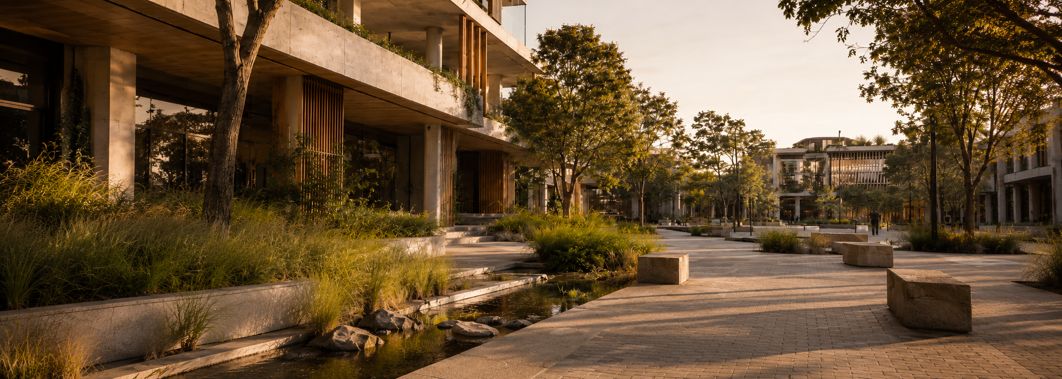
Water Sensitive Site Strategy
Practical guidance on coordinating stormwater quality, water reuse, permeability and landscape measures within a site-wide WSUD response.
For architects, developers, planners and project teams determining what may be required for planning approval and how water-sensitive measures should be incorporated into the project design.
Send Your Project DocumentsIn Brief
Water Sensitive Urban Design, commonly shortened to WSUD, is a planning and design approach that coordinates stormwater catchments, water-quality treatment, rainwater reuse, permeability and landscape-based measures across a development site.
Rather than treating stormwater as a separate late-stage consideration, WSUD incorporates appropriate measures into the site and landscape design. These may include rain gardens, bioretention areas, permeable paving, rainwater tanks, vegetated swales, passive irrigation systems and selected rooftop treatments.
A WSUD report may be required where a planning authority requests evidence of the proposed water-sensitive response. The appropriate scope depends on the applicable requirements, site conditions, runoff catchments, available space and proposed treatment measures. WSUD documentation may coordinate with civil stormwater information, but it does not replace detailed drainage or hydraulic design.
Runoff catchments, water-quality treatment, rainwater reuse, permeability and the integration of water-sensitive measures into the site and landscape design.
When a planning scheme, council policy, permit condition or request for further information requires a documented water-sensitive site response.
Through coordinated reporting, drawings, catchment information, treatment locations and alignment with the relevant landscape, planning and civil documentation.
Knowledge Navigation
Use this guide to explore how site runoff, water quality, treatment measures, landscape integration and planning requirements come together within a coordinated water-sensitive site response.
WSUD Strategy
Understand how runoff, treatment, water reuse, permeability and landscape measures are brought together within a site-wide WSUD strategy.
Site Runoff
Explore how roofs, driveways, paving, landscape areas and the site layout influence runoff pathways and the water-sensitive design response.
Water Quality
Learn how WSUD measures can reduce sediment, nutrients, litter and other pollutants before stormwater leaves the development site.
Landscape Integration
See how rain gardens, permeable paving, swales, planting areas and water reuse can be incorporated into the site design.
Assessment and Verification
Understand the difference between developing the broader WSUD response and testing the performance of selected treatment measures.
Planning Documentation
Review how council or planning requirements may be documented and what plans, schedules and site information are commonly required.
Site Water Strategy
WSUD stands for Water Sensitive Urban Design. It is a planning and design approach that considers how water moves through a development site and how the built environment can reduce its impact on stormwater systems, local waterways and surrounding environments.
In a conventional drainage response, stormwater may be treated primarily as something to collect and discharge. WSUD takes a broader site-based view by considering how water can be captured, slowed, filtered, reused, absorbed or integrated into landscaped areas before leaving the site.
A WSUD response may be required where a development needs to demonstrate how runoff, impervious surfaces, water quality, landscape areas and treatment measures have been coordinated as part of the planning approval pathway.
WSUD establishes the broader water-sensitive site strategy. It does not replace detailed civil drainage design, detention sizing or hydraulic calculations. Where quantitative water-quality verification is required, selected treatment measures may also be assessed through STORM modelling .
WSUD considers how roofs, paving, driveways, courtyards, landscape zones, site levels and treatment measures work together as part of the development’s overall water response.
Site runoff
Considers how roofs and other hard surfaces influence runoff pathways and the areas connected to treatment measures.
Water quality
Supports the reduction of sediment, nutrients, litter and other pollutants entering stormwater systems.
Landscape integration
Incorporates planting, permeable areas, rain gardens, swales and other landscape-based treatment measures.
Planning response
Documents how the proposed development responds to applicable council or planning-stage WSUD requirements.
Early Design Coordination
WSUD is most effective when it is considered alongside the site layout, architecture, landscape design and civil drainage strategy from the beginning. It should not be treated as a treatment measure added after the principal design decisions have already been made.
Early coordination allows suitable locations to be reserved for rainwater tanks, rain gardens, permeable surfaces, planting areas and maintenance access before those spaces are constrained by buildings, parking, services or circulation requirements.
A water-sensitive response depends on the relationship between catchment areas, proposed surfaces, landscape zones and the treatment measures available within the development. Changes to roof areas, paving, accessways or planting can therefore alter the practicality of the WSUD strategy.
Early review can identify whether the proposed measures are spatially realistic, whether the relevant catchments can be directed toward them and whether the design information is sufficiently coordinated for planning assessment.
Detailed drainage levels, pipe sizing, detention and hydraulic design remain the responsibility of the relevant civil or hydraulic consultant. The WSUD response should align with that work without replacing it.
01 / Site layout
Building footprints, setbacks, parking, services, accessways and landscape areas all influence the space available for a practical WSUD response.
02 / Catchment coordination
Roofs, paving and other impervious areas need to be understood as distinct catchments so the proposed treatment strategy reflects the actual design.
03 / Planning documentation
Architectural, landscape and drainage information should describe the same WSUD measures, locations and intended site-water response.
The required evidence and reporting format will depend on the relevant council and planning pathway. Review the WSUD planning documentation requirements .
Site Runoff
Stormwater behaviour is central to Water Sensitive Urban Design. Every development changes the way rainfall interacts with the site, particularly when roofs, driveways, paths, car parks and other impervious surfaces are introduced.
Areas that previously allowed rainfall to enter soil or move through vegetation may instead become defined runoff catchments. Water can then move across roofs and hard surfaces toward drainage points, landscaped areas or proposed treatment measures.
A WSUD response considers how these catchments relate to the wider site strategy. It identifies where runoff originates, how it moves through the development and which surfaces can realistically be connected to water reuse, filtration or landscape-based treatment measures.
As a site becomes more developed, the balance between permeable and impervious areas usually changes. Roofs, paving and vehicle access areas create distinct catchments that need to be understood as part of the proposed water-sensitive response.
Depending on the project, runoff may be directed toward rainwater tanks, permeable paving, rain gardens, vegetated areas, swales or other suitable treatment measures. The selected approach should reflect the actual site layout, available space and relevant planning requirements.
Detailed pipework, drainage capacity, detention sizing and hydraulic discharge design remain separate civil or hydraulic engineering matters. WSUD focuses on how the broader site layout and treatment strategy respond to water before it leaves the development.
Site conditions that matter
These areas form identifiable runoff catchments and may need to connect with reuse or treatment measures.
The arrangement and fall of the site influence whether runoff can be practically directed toward proposed WSUD measures.
Planting zones, available soil area and permeable surfaces affect where landscape-based measures may be feasible.
The effectiveness of the strategy depends on which catchments are connected to each tank, rain garden, swale or permeable area.
Once the site catchments are understood, the next question is how the proposed measures support the required water-quality outcome. Explore water quality and treatment .
Water Quality
Stormwater can collect sediment, litter, nutrients, oils, metals and other pollutants as it moves across roofs, roads, driveways, car parks and paved areas. A WSUD response considers how these pollutants may be reduced before runoff enters the drainage network or surrounding waterways.
Depending on the development and planning pathway, this may involve rain gardens, vegetated treatment areas, permeable paving, swales, filtration measures, rainwater tanks or other systems suited to the site.
The appropriate combination depends on the catchments being treated, the available space, the proposed landscape design, site conditions and the water-quality requirements identified by the relevant council or planning authority.
Water-quality objectives commonly address pollutants associated with urban development, including suspended solids, nutrients and gross pollutants. The WSUD strategy should show which measures are proposed, where they are located and which runoff areas are intended to connect to them.
Infiltration may form part of the response where site conditions are suitable. Permeable surfaces, landscaped areas and selected treatment systems can allow some rainfall to enter the ground rather than moving directly across hard surfaces.
Infiltration is not appropriate in every location. Soil conditions, slope, groundwater, contamination risks, building setbacks and drainage constraints may require further investigation by the relevant civil, geotechnical or environmental consultant.
Suspended solids
Sediment and fine particles carried from hard surfaces, landscaped areas and disturbed parts of the development.
Nutrients
Nitrogen and phosphorus may contribute to downstream water-quality problems when transported into waterways.
Gross pollutants
Litter and other visible material may need to be intercepted before stormwater enters the drainage network.
Treatment strategy
The selected measures need to suit the site and connect to the catchments they are intended to treat.
The required stormwater treatment outcome can vary according to the state, council, planning scheme, development type and assessment method. A WSUD response should therefore be based on the requirements that apply to the particular site rather than a generic treatment target.
The planning documentation should identify the proposed measures, show where they are located and explain which site catchments they are intended to treat. Where quantified verification is required, the performance of those measures may be assessed separately through an approved modelling pathway.
Where quantitative verification is required, the treatment performance of selected measures may be tested through STORM modelling . The next step is to consider how these measures can be incorporated into the landscape and site design .
WSUD Features
WSUD features vary depending on the site, project type, planning pathway and available space. A small residential development may require a different response from a townhouse site, mixed-use building, commercial development or larger urban renewal project.
The purpose of these measures is to help manage stormwater runoff, support water quality objectives, improve infiltration where suitable, reduce pollutant loads and integrate water-sensitive design into the built and landscaped environment.
A good WSUD strategy does not simply list features. It explains how those features work together, where they are located, how they respond to the site and how they can be maintained over time.
Rain gardens
Rain gardens are landscaped areas designed to receive stormwater runoff and help filter pollutants through soil, planting and engineered media.
Bioretention systems
Bioretention systems use planted zones and filter media to treat stormwater before it is discharged, reused or directed into the drainage network.
Permeable paving
Permeable paving allows water to pass through or between paved surfaces, helping reduce surface runoff where ground conditions are suitable.
Rainwater tanks
Rainwater tanks can capture roof water for irrigation, toilet flushing, laundry or other approved uses while also contributing to stormwater management.
Vegetated swales
Swales are shallow landscaped channels that can slow stormwater movement, filter runoff and connect drainage with landscape design.
Green roofs
Green roofs and vegetated building surfaces can contribute to stormwater retention, cooling, amenity and biodiversity where they are practical.
Not every project needs every WSUD measure. The appropriate response depends on council requirements, stormwater objectives, site grading, soil conditions, impervious area, landscape space, building layout and the level of assessment required for the planning submission.
Evidence and Coordination
A WSUD assessment reviews whether the proposed site-water strategy is appropriate for the development and supported by the project documentation. The assessment should connect the relevant runoff catchments, treatment measures, landscape areas and planning requirements in one coherent response.
This commonly involves reviewing architectural drawings, landscape plans, civil or stormwater information, proposed rainwater reuse, areas of hard and permeable surface, and the location of each WSUD measure.
The purpose is not simply to confirm that measures have been named. The information should show where they are located, which catchments connect to them and whether the strategy is consistently represented across the submission.
A broader WSUD review considers how the water-sensitive response works within the site design and planning submission.
Where a quantified treatment outcome is required, selected measures may also need to be tested through an approved modelling method such as STORM . That modelling supports the WSUD response but does not replace the broader site strategy.
Applicable requirements
The assessment first identifies the council controls, planning conditions or other water-quality requirements relevant to the site.
Catchment information
Roofs, paving, driveways and landscape areas should be identifiable so the runoff directed to each measure can be understood.
Proposed measures
Tanks, planted treatment areas, swales, permeable surfaces and other measures should be clearly located and described.
Design coordination
Architectural, landscape and drainage drawings should describe the same measures, locations and intended connections.
Access and maintenance
Measures requiring ongoing care should have a practical maintenance approach and remain accessible after construction.
Supporting verification
Where required, calculations or modelling may be provided to demonstrate the expected treatment performance of the strategy.
A clear WSUD report creates a traceable relationship between the applicable requirements, the proposed measures, the catchments being treated and the drawings submitted for approval.
The required report format and supporting evidence will depend on the relevant authority and approval pathway. Review how this is typically documented within the WSUD planning submission .
Planning Pathways
A WSUD report or WSUD response may be required as part of a development application, planning permit, council submission or environmental planning requirement. The exact pathway depends on the location, project type, council controls and the way stormwater and water quality requirements apply to the site.
In some projects, WSUD is requested as a dedicated report. In others, it may be addressed through stormwater documentation, sustainability reports, landscape plans, civil drawings or a broader planning submission. The important point is that the water-sensitive design response needs to be clear, coordinated and relevant to the approval pathway.
Because requirements vary between councils and jurisdictions, WSUD should be reviewed early. It can affect site layout, landscape zones, drainage strategy, rainwater tanks, permeable surfaces, treatment measures and the way documentation is prepared for assessment.
WSUD may be relevant where a development needs to demonstrate stormwater treatment, water quality management, runoff reduction, infiltration, rainwater reuse or a broader environmental response to site conditions.
It can apply to residential, townhouse, multi-residential, mixed-use and commercial projects, particularly where hard surfaces, roof areas, car parks, drainage constraints or landscape integration are important to the planning assessment.
The requirement may come from council planning controls, stormwater policies, development conditions, environmental planning frameworks or project-specific advice from the planning authority.
Development applications
WSUD may form part of the documentation submitted with a development application or planning permit.
Council requirements
Local councils may request evidence of water quality treatment, stormwater management or site-specific WSUD measures.
Planning conditions
Some projects need a WSUD response because it has been requested through a planning condition, request for further information or assessment pathway.
Consultant coordination
WSUD often needs to align with architects, planners, landscape architects, stormwater engineers and sustainability consultants.
WSUD can influence the physical design of a project. If it is considered too late, treatment measures may be difficult to locate, landscape areas may be insufficient, stormwater documentation may not align, or drawings may need to be revised before submission.
WSUD Report Requirements
The information required for a WSUD report depends on the project, council pathway, development type and level of assessment required. In most cases, the report needs enough project information to show how stormwater treatment measures are integrated into the actual site design.
A WSUD assessment is usually supported by architectural drawings, site layout plans, landscape information and stormwater or civil documentation. These documents help identify where runoff is generated, how water moves across the site and where treatment measures are proposed.
The stronger the documentation, the easier it is to prepare a clear WSUD response. If the drawings do not show the proposed treatment measures, rainwater tanks, permeable paving, landscape zones or maintenance access clearly, the project may need clarification before the report can be finalised.
A WSUD report should not describe a theoretical water-sensitive design that is not visible in the project documentation. The proposed measures need to be shown, located and coordinated with the broader drawing set.
This may include treatment measure locations, tank sizes, permeable paving areas, rain gardens, bioretention systems, swales, landscape zones, outlet points or other elements required by the planning pathway.
Where a council or planning authority requests additional details, the report may also need cross sections, construction notes, maintenance information or supporting calculations.
Site layout plan
Shows the building footprint, hard surfaces, landscape areas, accessways and the overall arrangement of the development.
Stormwater measures
Identifies rain gardens, tanks, permeable paving, swales, filtration systems or other proposed WSUD features.
Landscape information
Helps show how planting zones, permeable areas and treatment landscapes support the water-sensitive response.
Civil documentation
May be needed where drainage, levels, outlet points, detention systems or stormwater design details affect the WSUD strategy.
Design details
Cross sections, system details or construction notes may be required where treatment measures need to be explained more clearly.
Assessment pathway
Council requests, planning conditions or assessment tools help determine what level of WSUD documentation is required.
Maintenance arrangements
Some WSUD measures require ongoing maintenance to keep them functional after the development is built.
If the proposed WSUD features are visible in the drawings and coordinated with the landscape and stormwater design, the report can more clearly explain how the development responds to water quality, runoff and planning requirements.
Project Scope
The cost and timing of a WSUD report depend on the size of the development, the applicable planning pathway, the quality of the available drawings and the level of assessment required. A compact project with clearly documented measures will generally involve a different scope from a larger or less resolved development.
The main question is not simply how large the site is, but how much review, coordination and supporting evidence is needed to produce a clear and defensible water-sensitive design response. This may include catchment review, treatment measure coordination, drawing mark-ups, planning documentation and, where required, separate quantitative verification.
A project-specific review is therefore the most reliable way to confirm both scope and timeframe. Current drawings and any council correspondence usually provide enough information for an initial assessment.
A straightforward scope may involve reviewing a coordinated drawing set, confirming the proposed measures and preparing the required WSUD documentation.
Additional work may be needed where the planning requirement is unclear, catchments have not been defined, measures are missing from the drawings or the landscape and stormwater information do not yet align.
Larger or more complex developments may also require coordination across architecture, landscape, planning and civil documentation before the WSUD response can be finalised.
Development complexity
Multiple buildings, extensive hard surfaces, several runoff catchments or constrained landscape areas can increase the assessment scope.
Approval pathway
Council controls, permit conditions and requests for further information determine the required reporting format and supporting evidence.
Design resolution
Current and coordinated architectural, landscape and stormwater information allows the assessment to proceed with fewer assumptions.
Supporting verification
Where quantified treatment performance is required, separate calculations or STORM modelling may form part of the scope.
More efficient review
Usually possible where the applicable requirement is known and the proposed measures are already visible in the drawing set.
Additional coordination
May be required where measures need to be relocated, catchments clarified or project documentation brought into alignment.
Project-specific timeframe
The programme should reflect the actual reporting scope, required inputs and number of design revisions expected before submission.
Send the current project drawings, site address and any council request, planning condition or relevant stormwater-quality requirement. Landscape and civil information should also be included where available.
For a fuller list of typical inputs, review the project information usually needed for a WSUD report , or send the current documents for review .
Service Boundaries
WSUD, civil stormwater design and broader sustainability reporting can all contribute to the same planning submission, but they perform different functions. Understanding those boundaries helps the project team commission the right work and maintain consistency across the documentation.
A civil or hydraulic stormwater report typically addresses how water is collected, conveyed, detained and discharged. A WSUD report focuses on the water-sensitive site strategy, including runoff catchments, water-quality treatment, reuse, permeability and the integration of proposed measures into the site and landscape design.
Broader sustainability documents may reference the WSUD outcome alongside energy, materials, transport, waste and other planning-stage commitments. Those documents coordinate multiple sustainability categories but do not replace the detailed water-sensitive response.
WSUD Report
Coordinates runoff catchments, treatment measures, water reuse, permeability, landscape integration and the relevant planning-stage water-quality response.
Civil or Hydraulic Report
Addresses drainage levels, pipework, overland flow, detention, discharge points and other civil or hydraulic design requirements.
Broader Sustainability Report
Brings the WSUD outcome together with other planning-stage sustainability commitments without taking over the detailed water strategy.
Where several reports are required, they should use consistent information. Tank locations, connected roof areas, rain gardens, permeable surfaces, landscape treatment zones and relevant drainage connections should align across the drawing set.
A conflict between the WSUD report, landscape plan and civil documentation can make the proposed strategy difficult to assess and may lead to additional coordination or drawing revisions.
Related knowledge
Review how a Sustainability Management Plan or Sustainable Design Assessment coordinates several planning-stage sustainability commitments.
In relevant Victorian pathways, WSUD and stormwater evidence may support the water category within a broader BESS assessment .
WSUD defines and documents the water-sensitive site response. Civil or hydraulic consultants remain responsible for the detailed drainage, detention and discharge design where those services are required. The two scopes should be coordinated, but they should remain technically distinct.
Standards & Guidance Context
Water Sensitive Urban Design is shaped by a combination of state and territory policy, local planning requirements, stormwater objectives and technical guidance. There is no single national WSUD compliance pathway that applies uniformly to every project.
Planning Context
WSUD requirements are commonly established through state or territory planning policy, local planning controls and development approval requirements. Depending on the jurisdiction and project, these may address stormwater quality, runoff quantity, water conservation and the integration of water management into the site and landscape design.
Technical Context
The design and assessment of WSUD measures may draw on Australian Standards, state and local stormwater guidance, authority requirements and recognised industry methodologies. The relevant references depend on the type of development, proposed treatment measures, site conditions and the outcomes that need to be demonstrated.
Project Application
Council and approval authority requirements can differ significantly between locations. Treatment targets, modelling expectations, documentation and acceptable WSUD measures should therefore be established for the specific site and planning authority rather than assumed from a generic national approach.
Project-specific requirements: The applicable WSUD objectives, performance targets and documentation requirements should be confirmed against the current state or territory framework, local planning controls and requirements of the relevant council or approval authority.
Frequently Asked Questions
WSUD means Water Sensitive Urban Design. It is a planning and design approach that coordinates runoff catchments, water-quality treatment, rainwater reuse, permeability and landscape-based measures within a development site.
A WSUD report documents the proposed water-sensitive site strategy. It commonly identifies relevant runoff catchments, proposed treatment and reuse measures, landscape integration, applicable water-quality requirements and how the strategy is represented within the project drawings.
No. A civil or hydraulic stormwater report generally addresses drainage levels, pipework, detention, overland flow and discharge design. A WSUD report focuses on the water-sensitive site strategy, including treatment measures, water quality, reuse, permeability and landscape integration. Some projects require both scopes to be coordinated.
A WSUD response may be requested through a planning scheme provision, council policy, development application requirement, permit condition or request for further information. The requirement depends on the jurisdiction, site conditions, development proposal and applicable stormwater-quality controls.
Typical inputs include current architectural drawings, landscape information, identifiable roof and paved catchments, proposed WSUD measures, relevant civil or stormwater information and any council correspondence, planning condition or applicable policy. Additional sections, maintenance notes or calculations may be required depending on the pathway.
Common measures include rain gardens and bioretention areas, rainwater tanks, permeable paving, vegetated swales, passive irrigation areas and selected rooftop systems. The appropriate combination depends on the site, connected catchments, available space and approval requirements.
WSUD can direct runoff through measures intended to reduce suspended solids, nutrients, litter and other pollutants before stormwater leaves the development. The report should explain which measures are proposed and which runoff catchments they are intended to treat.
WSUD is the broader water-sensitive site strategy. STORM is a Victorian assessment tool that may be used to quantify the treatment performance of selected measures. A STORM result can support a WSUD response, but it does not replace the wider site, landscape and documentation review. Read more in the STORM Knowledge Hub .
Scope and timing depend on the development complexity, applicable approval pathway, quality of the available documentation, number of catchments and measures, coordination required and whether separate calculations or modelling are needed. Current drawings and council correspondence usually allow the scope to be confirmed more accurately.
Related Knowledge
WSUD defines the water-sensitive site strategy. Depending on the approval pathway, that strategy may be supported by quantitative treatment modelling or referenced within broader planning-stage sustainability documentation. These related Knowledge Hubs explain the boundaries between those services.
Treatment Verification
Understand how the Victorian STORM tool can be used to quantify the treatment performance of selected stormwater measures.
Planning Documentation
Explore how a Sustainability Management Plan or Sustainable Design Assessment coordinates WSUD with other planning-stage sustainability commitments.
Victorian Planning
Review how water and stormwater evidence can support one category within a broader Victorian built-environment sustainability assessment.
Unsure which document has been requested? Compare WSUD with stormwater and broader sustainability reports .
Project Review
Send the available architectural drawings, site information, landscape plans and relevant council correspondence for an initial review. Certified Energy can help identify the applicable WSUD scope and how the water-sensitive site response should be documented for the planning pathway.
Early review can also clarify whether separate STORM modelling, civil stormwater information or broader sustainability documentation is required, while keeping each scope technically distinct.
Last reviewed: June 2026. This page is maintained by Certified Energy as part of its Site and Environmental Performance Knowledge Hub.
