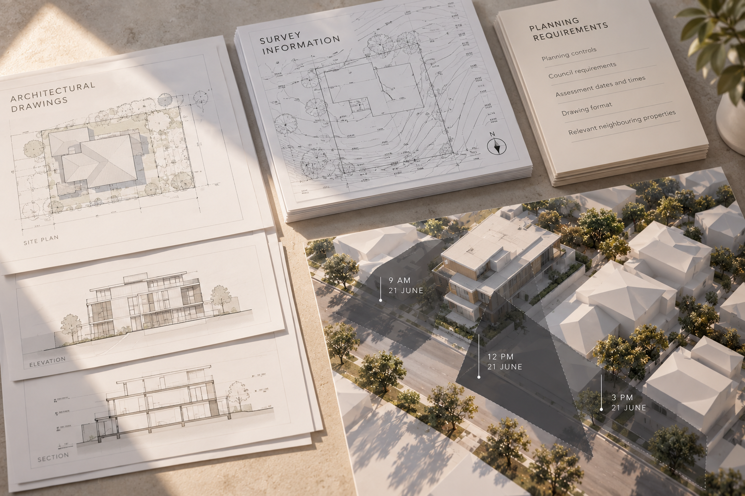



Shadow Diagrams
If a shadow diagram is being used to show how a proposed development affects its site and surroundings, it is reasonable to ask how closely that drawing represents the shadow that will actually occur. The reliability of the result depends not only on the shadow calculation itself, but on the building geometry, site orientation, levels and assessment conditions represented in the model.
In Brief
Shadow diagrams can provide a reliable geometric representation of where cast shadows will fall under defined conditions. Their reliability depends on the accuracy of the information used to build the model, including the proposed building geometry, site orientation, relevant levels, surrounding context and nominated date and time. A precise calculation cannot correct inaccurate or outdated project information.
How accurate are Shadow Diagrams?
A well-prepared shadow diagram can provide a reliable representation of the shadow cast by a proposed or existing building at a nominated date and time.
The important qualification is that the calculated shadow is based on a model. That model needs to represent the development and relevant site conditions correctly for the resulting diagram to be reliable.
If the proposed building height, roof form, orientation or site levels are incorrect, the calculation may be internally consistent while still representing the wrong physical condition.
For this reason, accuracy is better understood as the relationship between reliable project information, correct assessment conditions and consistent geometric modelling rather than as a feature of the software alone.
What determines Shadow Diagram accuracy?
Several pieces of information work together to determine where a modelled shadow falls. The proposed building needs to be represented at the correct position, height and form. The site needs to be oriented correctly. Relevant ground and building levels need to reflect the actual spatial relationship between the development and its surroundings.
The assessment conditions matter as well. The position of the sun changes with location, date and time, so the model needs to use the conditions required for the particular shadow study.
Where surrounding buildings or other site features are relevant to what the diagrams need to show, those elements also need to be represented with an appropriate level of accuracy.
The information required will vary between projects. For a closer look at the inputs that may be needed, see What Information Is Needed to Prepare Shadow Diagrams?
A Shadow Diagram is only as reliable as the geometry, orientation, levels and assessment conditions represented in the model. Precision in the calculation cannot correct inaccurate project information.
Why does true north matter?
The orientation of the site determines how the proposed building sits in relation to the sun. Establishing true north correctly is therefore fundamental to the direction of the calculated shadow.
If a building is rotated incorrectly within the model, its relationship with the sun is also changed. The resulting shadow may then extend in a different direction from the shadow produced by the correctly oriented development.
This is why orientation is more than a drawing convention. It is part of the geometry used to determine where the shadow falls.
Reliable survey and site information can help establish that orientation before the shadow model is prepared.
Do building heights and site levels affect the shadow?
Yes. A building footprint can be positioned correctly on a site while the resulting shadow is still misrepresented if the relevant heights or levels are wrong.
Building height affects the extent of the cast shadow. Roof forms, parapets, upper storeys, balconies, screens and other built elements may also alter the shadow where they are relevant to the proposed design.
Site levels establish the vertical relationship between the building, the ground and surrounding properties. On a sloping site, for example, simply representing the development on a flat plane may not describe the actual spatial relationship that exists on the land.
The model therefore needs enough vertical information to represent the conditions that matter to the shadow study, rather than relying only on the two-dimensional position of the building.
What if information about neighbouring properties is incomplete?
Not every shadow study requires the same level of information about neighbouring properties. What matters is whether the surrounding context is relevant to what the diagrams need to document.
If proposed shadow extends onto adjoining land, information about property boundaries, surrounding buildings or other relevant features may be needed to show where that shadow falls. The appropriate level of detail depends on the project and applicable planning requirements.
Where reliable information is unavailable, the limitation should be understood rather than hidden behind apparent modelling precision. A detailed model of an uncertain neighbouring condition does not make the underlying information more certain.
The objective is to represent the surrounding context to the level necessary for the particular shadow assessment, using information that can reasonably support that representation.
Can an accurate Shadow Diagram still be unsuitable for a planning application?
Yes. Geometric accuracy and planning suitability are related, but they are not the same thing.
A model could accurately calculate the shadow for the conditions entered into it but still fail to provide the documentation required for the project. The wrong assessment date, an inappropriate time interval, missing comparison information or an incomplete drawing extent can all affect whether the diagrams answer the planning question being asked.
This is why the applicable planning requirements should be established alongside the technical inputs. Accuracy is not only about calculating a shadow correctly; the calculation also needs to represent the condition that the assessment is intended to examine.
For example, 21 June is frequently used as a winter assessment date, but it should not be treated as a universal requirement. The relevant date and times still depend on the project and planning framework. See Why Is 21 June Used for Shadow Diagrams in Australia?
Are Shadow Diagrams exact predictions of real-world conditions?
A shadow diagram is best understood as a geometric representation of cast shadow under defined conditions. It is not intended to reproduce every aspect of how the site will visually appear at that moment.
The diagram represents the relationship between the sun position and the modelled built form at the nominated location, date and time. Its purpose is to show the resulting cast shadow in a form that can be documented and compared.
Actual outdoor conditions also include variables such as cloud cover and diffuse light. Those conditions affect how light and shadow may appear to someone standing on the site, but they are not what a planning shadow diagram is principally designed to document.
The useful question is therefore not whether the diagram behaves like a future photograph. It is whether it reliably represents the cast shadow geometry required for the assessment.
What happens if the proposed design changes?
Shadow diagrams represent the design information used when the model was prepared. If that design changes, the shadow condition may change with it.
Changes to building height, setbacks, upper-level massing, roof form or other relevant elements can alter the extent or direction of the proposed shadow. A small drawing revision does not necessarily produce a meaningful shadow change, but the significance depends on what was altered.
This is why the drawing revision used for the assessment matters. A technically accurate diagram based on an earlier design may no longer represent the current proposal.
Where the design changes after the shadow study has been prepared, the relevant changes should be reviewed to determine whether the diagrams also need to be updated.
How can you tell whether a Shadow Diagram is reliable?
You do not need to reconstruct the modelling yourself to understand whether the foundations of the diagram are sound.
Start by checking whether the diagram corresponds with the current proposed design and clearly identifies the assessment date and time. The site orientation should be established, and the relevant building heights and levels should correspond with the project information used for the assessment.
Where existing and proposed shadow conditions are being compared, the drawing should also make those conditions understandable rather than leaving the reader to infer which shadow belongs to which scenario.
Finally, the diagrams should respond to the scope of the actual assessment. A highly detailed drawing is not automatically a reliable planning document if it models the wrong design, uses the wrong assessment conditions or omits information needed to understand where the shadow falls.
Accuracy within the wider shadow assessment
Reliable shadow documentation begins with a simple principle: the model needs to represent the development and assessment conditions that actually apply to the project.
Accurate geometry establishes the proposed built form. Correct orientation and levels establish its relationship with the site. The nominated date and time establish the solar condition under which the shadow is calculated. Relevant surrounding information provides the context needed to understand where that shadow falls.
When those foundations are reliable, shadow diagrams can provide clear graphical evidence of the existing and proposed shadow conditions at the nominated assessment times.
That evidence can then be used within the wider planning assessment without confusing modelling precision with assumptions about the project information on which the model depends.
Continue Reading
Understand the wider role of Shadow Diagrams
Accuracy is one part of reliable shadow documentation. Explore what shadow diagrams show, how they are prepared and how they support planning and development applications.
Explore the Shadow Diagrams guide →Shadow Diagrams
Need reliable Shadow Diagrams for your project?
Reliable shadow documentation depends on the proposed design, site information and assessment requirements being represented correctly.
Send us your current plans, survey and available planning information. We can review the project and help identify the appropriate shadow assessment pathway.
Start Your Project