Viewshed Analysis
How Viewshed Analysis Helps Assess Landscape and Community Visibility
Viewshed analysis helps project teams understand where a proposed development may be visible from and how that visibility relates to surrounding landscapes, public viewpoints and community settings.
Landscape and community visibility can become important when a project is located near ridgelines, open spaces, public reserves, scenic corridors, waterways, rural land or established neighbourhood viewpoints.
Viewshed analysis does not decide whether a view should be protected or whether a proposal is visually acceptable. Its role is more specific. It helps identify where a proposal may be seen from, which viewpoints may be relevant and where further planning or visual assessment may be needed.
Why landscape visibility matters in planning
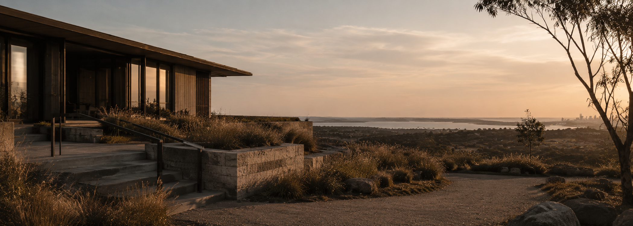
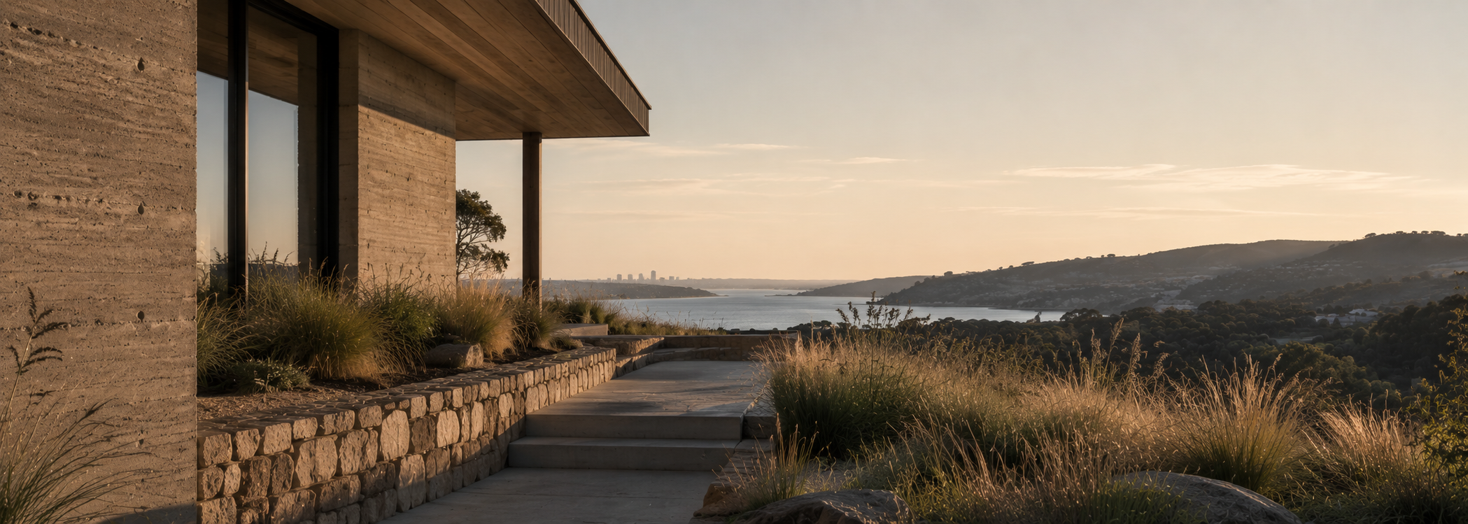
Some sites are more visually sensitive than others. A proposal on flat urban land may have limited visual exposure, while a building, structure or infrastructure element on elevated or open land may be visible from a much wider area.
In landscape settings, visibility may be shaped by ridgelines, valleys, coastal edges, rural openness, waterways, escarpments, vegetation and public access. These conditions can influence how a proposal is understood during planning review.
Viewshed analysis helps make these relationships clearer by mapping potential visibility and identifying the locations from which a proposal may be visually connected to its surrounding context.
Community views and public viewpoints are not always the same
Community visibility is often discussed broadly, but planning assessment usually needs a more specific understanding of viewpoints. A view from a public road, reserve, lookout, foreshore path or walking trail may be considered differently from a private or incidental view.
Viewshed analysis helps distinguish between different types of visibility so that project teams can focus on the viewpoints that are most relevant to the planning question.
Public viewpoints
Roads, reserves, parks, lookouts, waterways, walking paths and other shared places where a proposal may be experienced by the wider community.
Private viewpoints
Views from neighbouring properties or private land that may be relevant depending on the project, council request and planning context.
How line of sight analysis supports clearer decisions
Line of sight analysis considers whether there is a visual connection between an observer point and a proposed building, structure or visible element.
This can help project teams understand whether the proposal may be visible above a ridgeline, across a valley, from a road corridor, from a public reserve or from another relevant location.
The analysis may also show where terrain, existing built form, distance or vegetation assumptions reduce visibility. This gives planners and design teams a clearer evidence base when discussing landscape or community visibility.
What viewshed analysis can help identify
A viewshed assessment can help clarify the visibility relationship between a proposal and its setting.
Viewshed analysis supports planning clarity, not automatic approval
It is important not to overstate what viewshed analysis does. A viewshed assessment does not guarantee planning approval, remove the need for planning advice or automatically resolve community concerns.
Its value is that it makes visibility easier to understand. This can help project teams respond to council questions, prepare clearer development application material, coordinate with planning consultants or decide whether further visual assessment work is required.
Used early, it can also help avoid uncertainty by bringing visibility questions into the design and planning process before they become harder to manage.
How Certified Energy approaches landscape visibility
Certified Energy provides viewshed analysis as part of its design and planning intelligence services. The work is supported by Urbanfinity spatial data capability and interpreted through an architectural planning lens.
This helps translate spatial data into practical site visibility intelligence, including terrain context, public viewpoint relevance, line of sight relationships and potential built form exposure.
The aim is not to make broad claims about visual acceptability. The aim is to help project teams understand where landscape and community visibility may matter within the planning process.
Landscape Visibility
Need to understand how visible your proposal may be?
If landscape visibility, community views or public viewpoints may become part of your planning pathway, viewshed analysis can help clarify the issue early.
Certified Energy can review your site, proposal and planning context to advise whether viewshed analysis is suitable and what information may be needed.